File:1597 Alkmaar CD kaart.jpg: Difference between revisions
Jump to navigation
Jump to search
No edit summary |
No edit summary |
||
| Line 1: | Line 1: | ||
Map of Alkmaar by Drebbel in 1597. Data by <span style="color: rgb(37, 37, 37); font-family: sans-serif; font-size: 14px; line-height: 20.7999992370605px;">Adriaen Antoniszn.</span>{{#display_map: | Map of Alkmaar by Drebbel in 1597. Data by <span style="color: rgb(37, 37, 37); font-family: sans-serif; font-size: 14px; line-height: 20.7999992370605px;">Adriaen Antoniszn.</span>{{#display_map: | ||
52. | 52.63143179486071,4.748271739665142~ ~ ~ ~ ~Alkmaar; | ||
|height=300 | |height=300 | ||
|width=600 | |width=600 | ||
Latest revision as of 20:24, 23 November 2020
Map of Alkmaar by Drebbel in 1597. Data by Adriaen Antoniszn.
File history
Click on a date/time to view the file as it appeared at that time.
| Date/Time | Thumbnail | Dimensions | User | Comment | |
|---|---|---|---|---|---|
| current | 14:24, 7 January 2015 | 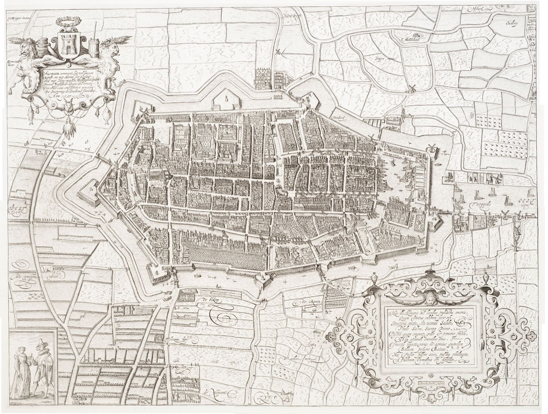 | 1,831 × 1,384 (1.05 MB) | Admin (talk | contribs) |
You cannot overwrite this file.
File usage
The following 4 pages use this file: